Super Typhoon Bavi hit 290 km/h winds, becoming 2026’s third Category 5 storm
Super Typhoon Bavi reached sustained winds of around 290 kilometres per hour, becoming the third Category 5 tropical cyclone of 2026.
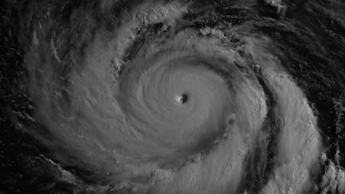
Super Typhoon Bavi arrived as an exceptionally powerful storm in early July, crossing near Guam and the Northern Mariana Islands with destructive winds, heavy rain and dangerous coastal flooding. According to NASA, the cyclone reached its greatest strength as it passed through the region, becoming the third Category 5 tropical cyclone of 2026.
The typhoon reached super typhoon status on July 4 local time while moving west across the Pacific. By the time it approached Guam and the Northern Mariana Islands, sustained winds had climbed to around 290 kilometres per hour, fuelled by sea surface temperatures of around 30 degrees Celsius along its path — warm water that acts as fuel for tropical cyclones, strengthening the thunderstorms around the storm’s centre.
One of the most striking views of Bavi came from a NASA-supported satellite observation taken shortly after midnight local time on July 6, showing the storm’s eye surrounded by a tightly organised eyewall, with moonlight illuminating part of the cyclone from above. The image was collected by the Visible Infrared Imaging Radiometer Suite aboard the NOAA-20 satellite, capturing Bavi near peak intensity just before its eye moved across Rota, one of the islands in the Northern Marianas.
Meteorologists have been watching the 2026 Pacific season closely because of developing El Niño conditions, which can allow storms forming farther east to spend more time over warm water before turning towards Asia — increasing the chances of reaching the highest intensity categories.


Leave a Reply